
Near Plitvice Lake National Park, Croatia
The area surrounding the famous Plitvice Lakes National Park and its waterfalls is quietly scarred by the Croatian War of Independence (1991-1995). While the tourist-friendly waterfalls remained largely untouched, the surrounding Lika region was an early and sustained frontline. Abandoned houses and farmsteads in nearby villages, often left by displaced populations, still stand with doors hanging open or missing, offering a stark contrast to the natural beauty just kilometers away. The conflict began right here with the Plitvice Lakes incident in March 1991, an early clash that marked the first casualty of the war. The entire region was subsequently held by Serb forces for years and experienced widespread, brutal destruction of small settlements before being retaken by Croatia, leaving a legacy of ruined property and a demographically altered landscape.

Near Plitvice Lake National Park, Croatia
The profound demographic reversal in the region surrounding Plitvice Lakes National Park, brought about by the Croatian War of Independence (1991–1995), left behind a physical landscape of widespread abandonment and destruction. While the war involved an initial displacement of Croat residents, the most impactful population shift was the definitive, mass exodus of approximately 200,000 ethnic Serbs from the broader Krajina region during and after the 1995 Croatian offensive, Operation Storm.1 This displacement, which fundamentally transformed the region's demography, resulted in an enduring visual legacy of war-time devastation. The fleeing population left behind vast numbers of private homes, agricultural buildings, and villages that were subsequently looted, vandalized, or deliberately destroyed. This dramatic shift created a landscape marked by thousands of abandoned structures, often characterized by shell damage, collapsed roofs, and bullet-pocked walls, standing as silent and powerful evidence of the conflict and the ensuing humanitarian crisis that prevented the return of many displaced residents.

Ston Salt Pans, Croatia.
The Ston Salt Pans in Croatia are among the oldest in the world, with a 4,000-year history dating back to prehistoric times when the area was known as "Stagnum" by the Romans. Their golden age began in 1333 when the Republic of Dubrovnik (Ragusa) acquired the territory, establishing a state monopoly that made the salt, nicknamed "white gold," responsible for up to one-third of the Republic's total revenue. To protect this vital economic engine, the Republic constructed the massive Walls of Ston during the 14th and 15th centuries. The traditional, entirely manual harvesting method remains in use today, relying on a complex system of 58 shallow pools where seawater is naturally evaporated by the sun and wind. After one to two months, the brine flows into the nine final crystallization pools—many named after saints—where the pure crystals are formed and scraped by hand using wooden rakes and shovels. The harvested salt is then loaded into small carts, historically pulled by donkeys for transport to stone warehouses. This system reflects the community's values, especially through the Mundo crystallization pool, from which the salt was historically set aside and given to the poor to aid them in food preservation.

Sebastopol, California, USA
The Gravenstein apple is profoundly important to the history and identity of Sebastopol, California, defining the area's agricultural heritage for over a century. From the late 19th century into the mid-20th century, the Gravenstein was the dominant cash crop in Sonoma County, earning Sebastopol the title of the "Gravenstein Capital of the World." Its early harvest made it ideal for shipping, and the local economy thrived on the fruit, supporting numerous canneries, processing plants, and dehydrators in and around town. Although the number of orchards has dramatically declined due to urbanization and market pressures, the Gravenstein remains a treasured local symbol, celebrated annually during the Gravenstein Apple Fair, preserving a vital piece of the region's agricultural past and community pride.

Sebastopol, California, USA
The 1936 Ford Orchard Truck was a specialized version of the standard Ford half-ton pickup, designed specifically for agricultural use. Its defining feature was a low-profile design—often a flat-bed or low-slung stake bed—engineered to pass underneath the low-hanging branches of fruit trees without causing damage during harvest. Like the standard '36 Ford, it featured an all-steel cab and was powered by the reliable, 85 horsepower 221 cubic inch Flathead V-8 engine, making it a durable and efficient tool highly valued by farmers. Rather than being operational, some of these classic Ford workhorses can now be found sitting deep within the older orchards and vineyards of places like Sonoma County, weathered and static, a picturesque relic of time; these rusted artifacts stand as tangible monuments to the industrious past and the history of California's agricultural boom.

Sebastopol, California, USA.
The Great Blue Heron is a commanding sight across Northern California's wetlands, standing still in the shallow estuaries and sloughs before unleashing a powerful, quick strike to capture its preferred prey of fish and frogs. However, this seemingly aquatic hunter is surprisingly versatile, frequently foraging on land in fields and meadows where its sharp bill makes it an efficient predator of voles, gophers, and other small mammals. Sebastopol, California, USA.

Santa Rosa, California, USA
The large hand sculpture, officially titled "Agraria," was a highly visible downtown landmark at the entrance of the Santa Rosa Plaza from its installation in December 1996 until its removal in May 2025. Created by artist Larry Kirkland from a single 7.5-ton block of Carrara marble, the 12-foot-long sculpture was designed to honor the diverse cultures—including the Pomo and various settlers—who cultivated the soil of Sonoma County, symbolizing the act of casting or receiving seeds. Although controversial at times, the sculpture served as a central piece of local public art for nearly three decades before being relocated to the Geyserville Sculpture Trail as part of the mall's renovation project.
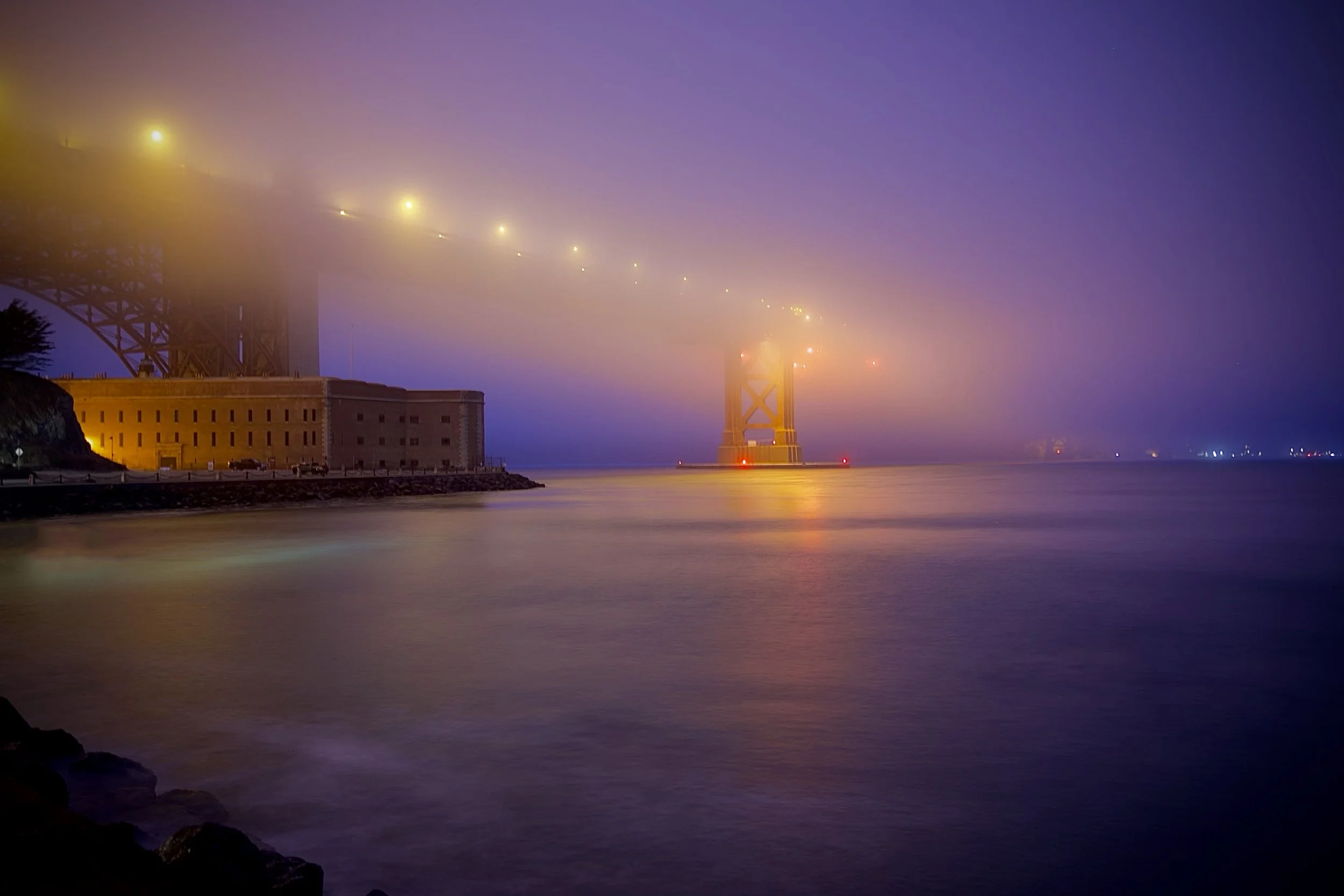
San Francisco, California, USA
The image captures a dramatic nighttime scene dominated by an ethereal, thick fog and a vibrant purple and orange color cast. In the foreground, the calm water reflects the ambient light, leading the eye toward the historic, large masonry structure of Fort Point, which stands illuminated against the mist. Looming above and partially obscured by the dense fog is the massive steel structure of the Golden Gate Bridge, with its lights glowing warmly. The fog creates a striking, mysterious atmosphere, partially swallowing the bridge's main tower and transforming the scene into a moody, dreamlike tableau of San Francisco's iconic landmarks.
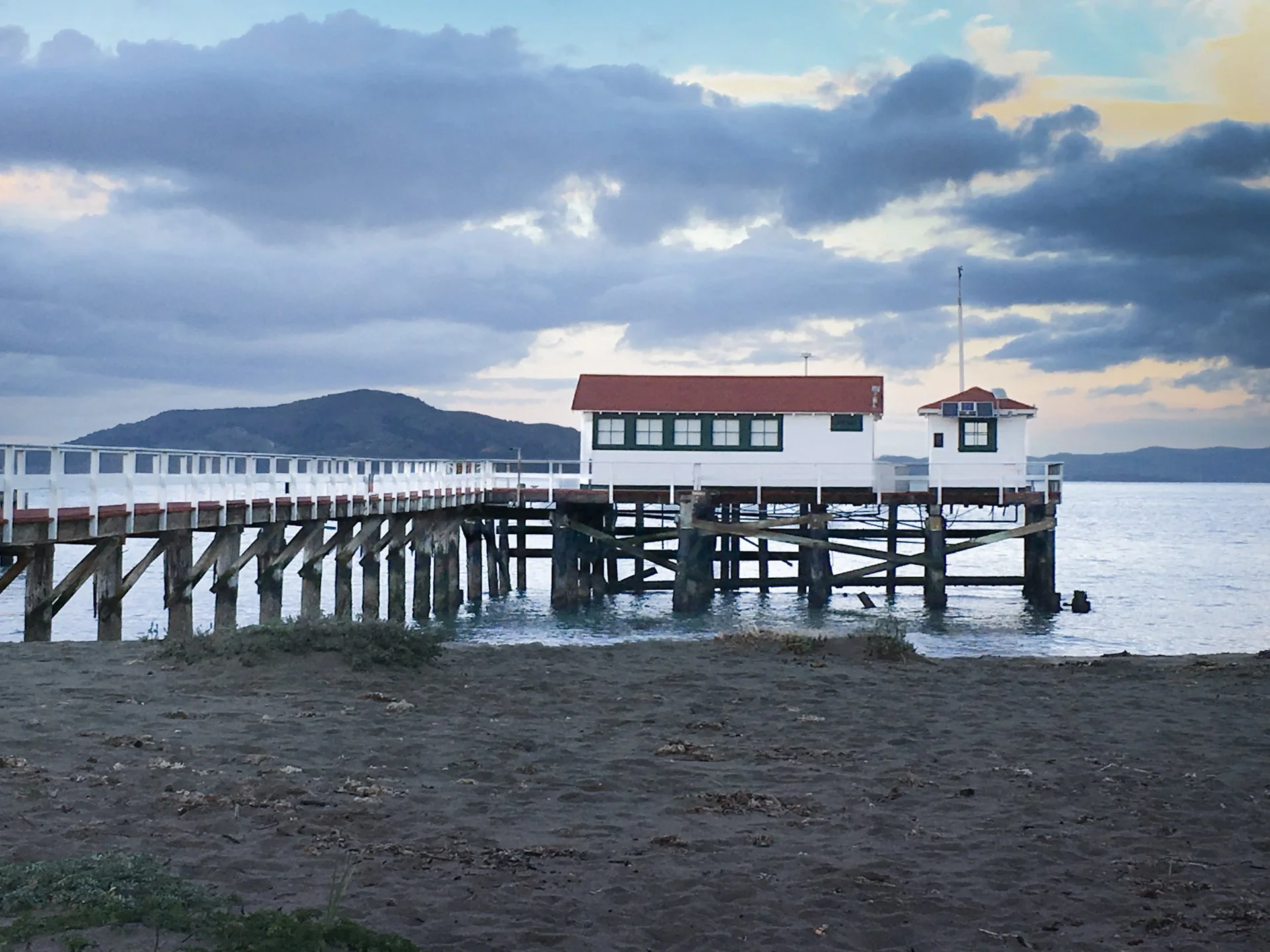
San Francisco, California, USA
The photograph features a historic pier and small structure situated on the edge of the San Francisco Bay, just west of the Golden Gate Bridge. The San Francisco Bay is a critical estuary, the largest on the West Coast, serving as a vital natural harbor, a hub for global shipping, and a unique ecological meeting point where freshwater rivers mix with the saline ocean. The image itself captures a wooden pier extending into the water, supporting a charming, white building with a distinctive red roof of an old boathouse. The scene is characterized by the soft, diffused light of a cloudy evening, with dark, rolling clouds hanging over the hills in the background, contrasting with the pale colors of the bay and the dark foreground of the beach.
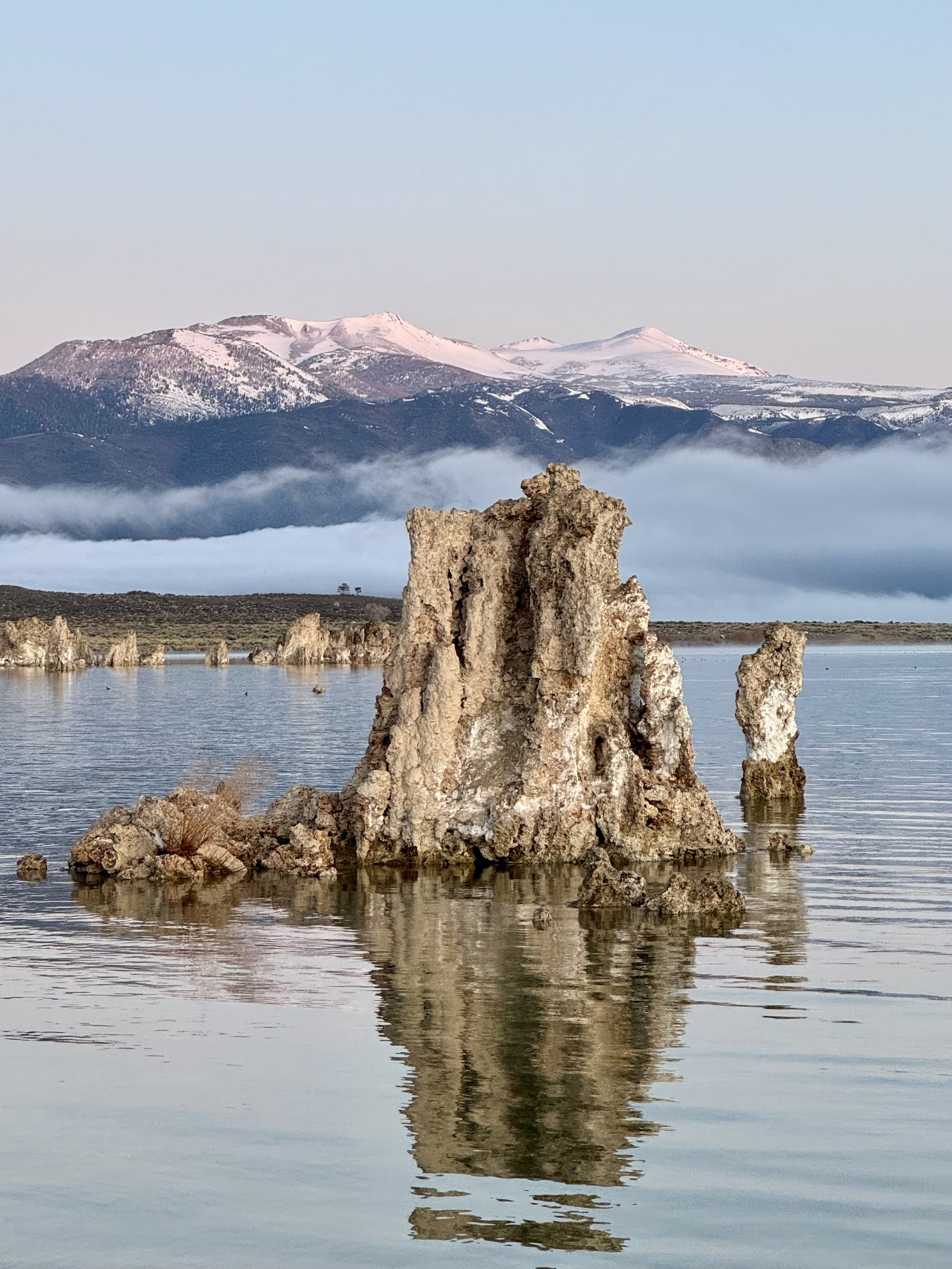
Mono Lake, California, USA
The striking photo captures the otherworldly beauty of Mono Lake at sunrise, dominated by a large, rugged tufa tower rising directly from the calm, reflective water. Tufa is a porous limestone formed when calcium-rich freshwater springs bubble up from the lake floor and react instantly with the lake’s concentrated carbonates. This dramatic tower, reflecting perfectly in the pale water, emphasizes the tufa’s bizarre, ancient geology. In the distance, a blanket of low-lying fog hangs over the far shore, providing a soft contrast to the snow-capped Sierra Nevada mountains which glow pink in the early morning light.
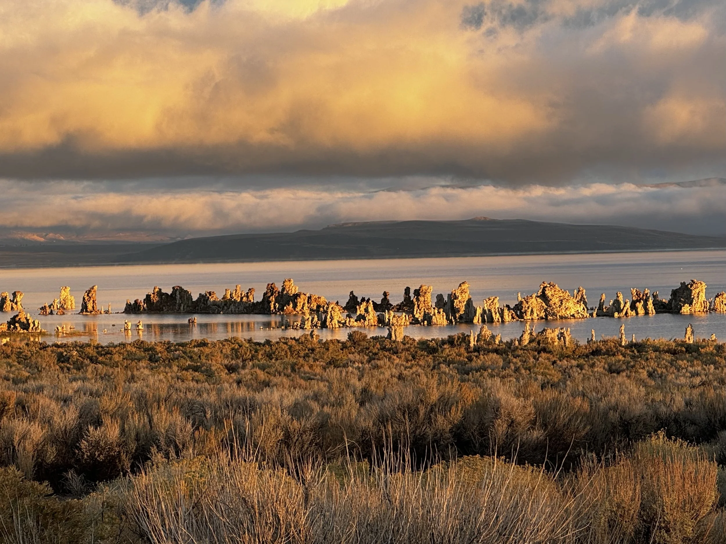
Mono Lake, California, USA
The image, taken at Mono Lake in the eastern California high desert, beautifully captures a dramatic sunrise over the ancient saline lake. In the foreground, dense, silvery-green Big Sagebrush highlights the arid regional flora, while the middle ground features the lake's iconic, strange Tufa Towers, which are brightly illuminated by the golden light striking the tops of the massive clouds above. The light bathes the entire scene—from the calm water reflecting the sky to the distant, dark Sierra Nevada mountains—in a warm, contrasting palette of gold and cool blue-gray, emphasizing the otherworldly beauty of this unique, high-desert landscape.
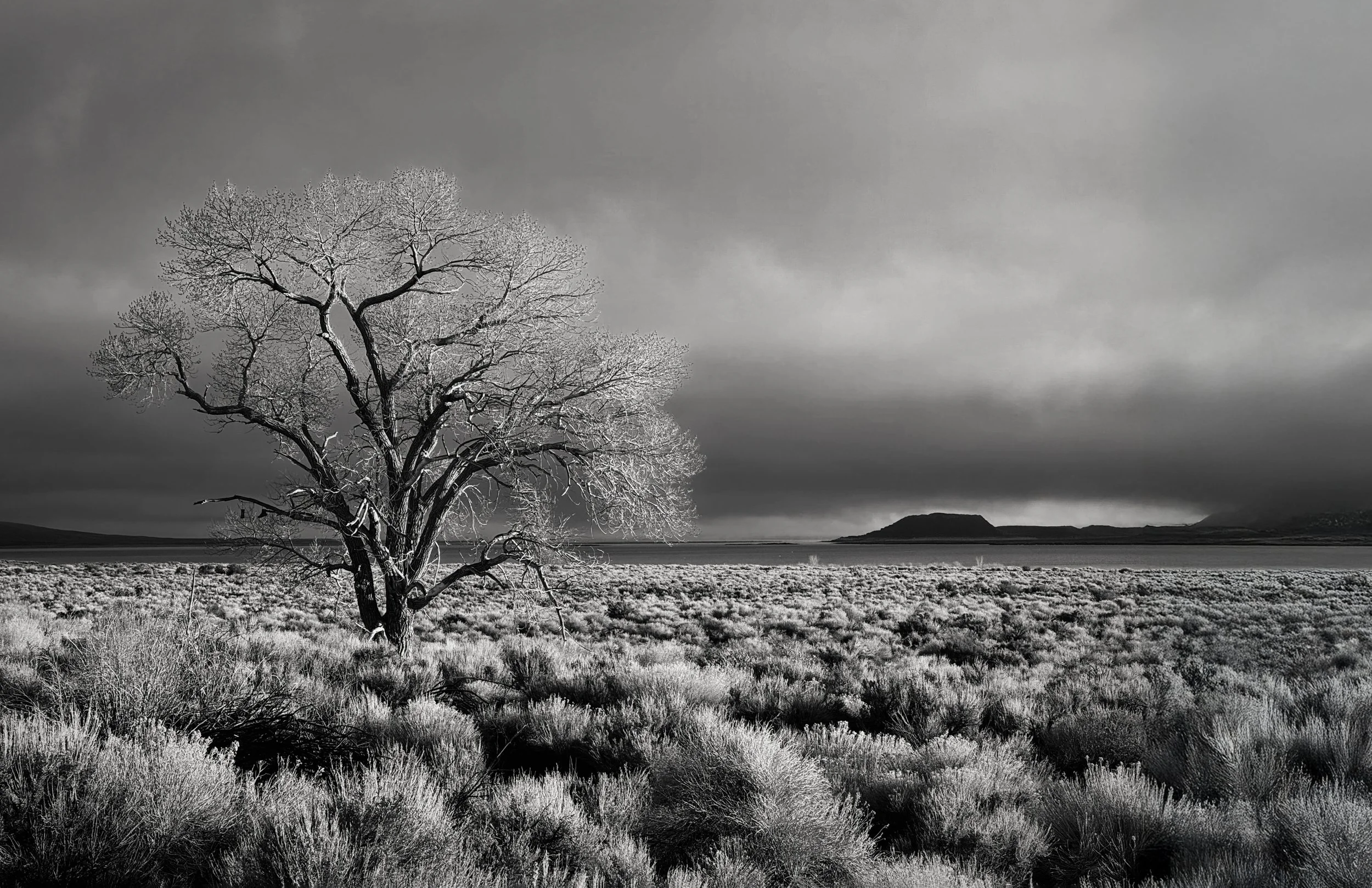
Mono Lake, California, USA
Mono Lake is a striking natural wonder in the California high desert, famous for its saline and alkaline waters and the dramatic Tufa Towers exposed by past water diversion. While the lake sustains an efficient food web of brine shrimp for millions of migratory birds, the surrounding arid landscape is dominated by hardy Big Sagebrush and Pinyon Pine. Only in the freshwater riparian zones are groves of Quaking Aspen and vibrant wildflowers found, illustrating the sharp contrast between the lake's harsh, mineral-rich basin and its life-sustaining water sources.

Mount Whitney, California, USA
This stunning photograph, taken from the Alabama Hills near Lone Pine, captures the majestic Mount Whitney and its neighboring peaks at sunrise. The foreground is dominated by large, rounded granite boulders characteristic of the Alabama Hills, leading the eye upward to the rugged, snow-dusted Sierra Nevada mountains. The highest peaks are bathed in the soft, dramatic light of the rising sun, which paints the clouds above with delicate pink and purple hues against a muted blue sky. Mount Whitney, standing at 14,505 feet (4,421 meters), is the highest peak in the contiguous United States and is located in the Sierra Nevada range on the boundary of Sequoia National Park and Inyo National Forest in California. Its imposing granite structure was formed by ancient magma cooling beneath the Earth's crust, followed by immense uplift and carving by Ice Age glaciers.

Zagreb, Croatia
Zagreb's history began in the Middle Ages as two rival settlements—the fortified burgh of Gradec and the ecclesiastical Kaptol—which eventually unified to form the modern city and the capital of Croatia. Its downtown shopping area, centered on Ilica Street and Ban Jelačić Square, reflects this heritage, blending grand Austro-Hungarian architecture with modern commerce. This vibrant, walkable hub offers a mix of international retail chains, local Croatian designer boutiques, and traditional shops. Zagreb's proximity to key regional routes, including historical trade paths connecting Central Europe to the Adriatic Sea, and its strategic location near navigable rivers like the Sava (a tributary of the Danube), helped it become an important trading nexus for goods traveling in the wider Danube region during the early medieval period.
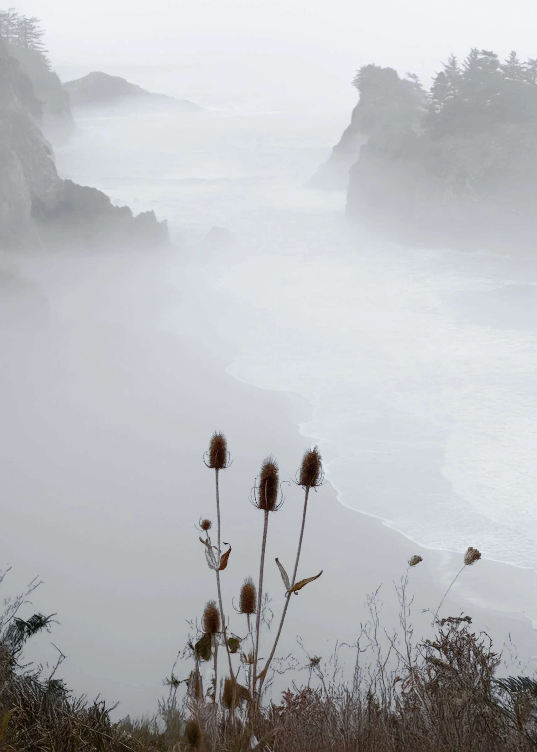
Near Brookings, Oregon, USA
The foggy Oregon Coast transcends simple weather to become an ethereal, cinematic aesthetic, where the thick marine layer serves as a vast, natural softbox, bathing the rugged landscape in a diffused, monochromatic silver light. By obscuring the horizon and veiling the distance, the fog transforms giant sea stacks into spectral, looming silhouettes to an emerging sense of mystery. A simple thistle plant contrasts the soft lines of the fog and coast with the prickly sharpness of the plant, balancing the image. This pervasive dampness and stillness contribute to a profound atmosphere of serenity and isolation, making the coast feel ancient, untamed, and deeply romantic, where its beauty lies not in brightness but in the compelling nature of its shrouded mystery.

San Juan Islands, Washington, USA
The image captures the interior of a ferry heading toward Friday Harbor in the San Juan Islands, a scenic archipelago in the Pacific Northwest known for its temperate climate, forested islands, and abundant marine wildlife (including orcas). The photo, rendered in black and white, emphasizes the ferry's utilitarian design, with long rows of identical cushioned seats and tables facing large rectangular windows. The lighting—a repeating pattern of bright overhead fluorescent fixtures—creates a rigid, grid-like composition on the ceiling, starkly contrasting the soft, blurred forms of passengers looking out at the passing landscape, capturing a moment of quiet, communal journey across the waters of the Puget Sound region.
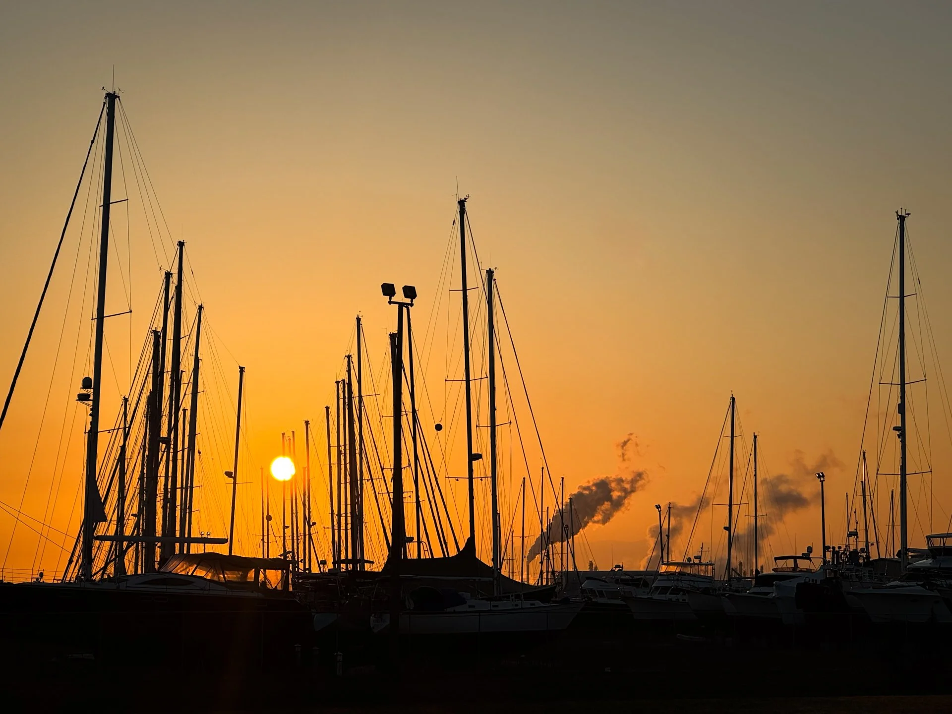
Anacortes, Washington, USA
The photograph captures a tranquil yet striking sunrise at a marina along Puget Sound in Anacortes, where the silhouette of numerous sailboat masts and rigging dominates the foreground against a vibrant orange and yellow sky. While the harbor is a gateway to the San Juan Islands, the scene subtly features a plume of steam or smoke rising in the distance, hinting at the powerful March Point oil refineries, emphasizing the area's unique blend of recreational sailing and heavy industry.
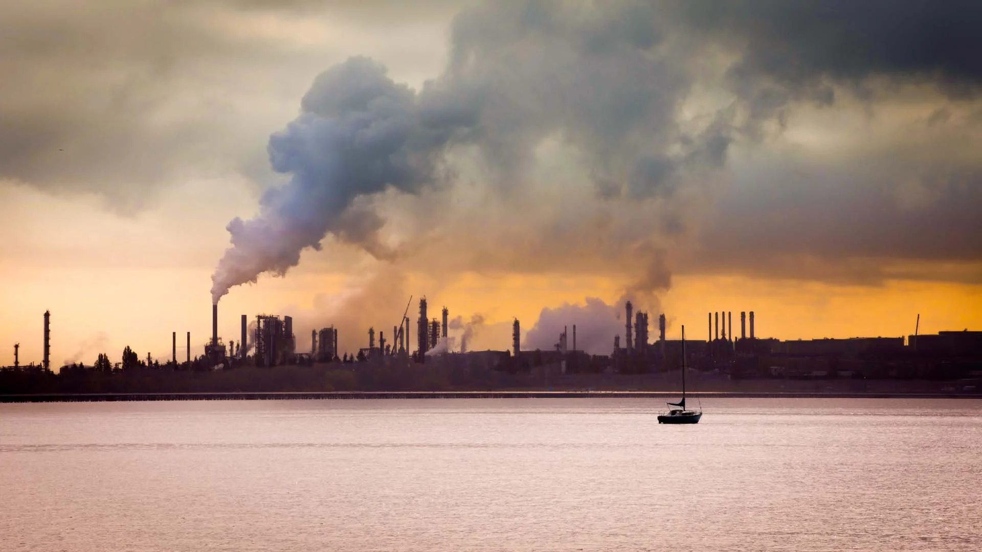
Anacortes, Washington, USA
The photograph captures the dramatic visual contrast between heavy industry and nature at March Point near Anacortes, Washington. The background is dominated by the sprawling oil refinery complex, identifiable by its towering smokestacks and industrial structures, emitting large plumes of steam and smoke that merge with the overcast, orange-hued sunrise sky. This stark, imposing industrial scene is softened by the foreground, where the calm waters of Puget Sound reflect the glow, and a single, small sailboat drifts peacefully. The sailboat provides a sense of scale and natural repose, highlighting the juxtaposition of a powerful industrial landscape with the tranquility of the Northwest marine environment.

Oslo, Norway
The Oslo harbor scene contrasts a historic past with modern function: the large tall ship on the right, recognizable by its masts and rigging, represents Norway's rich maritime history as a trading and sailing nation. Docked alongside it is a lower, wider motorized utility vessel (likely a local passenger ferry or service boat), representing the efficient, everyday transport and modern commerce of the working fjord and city today.
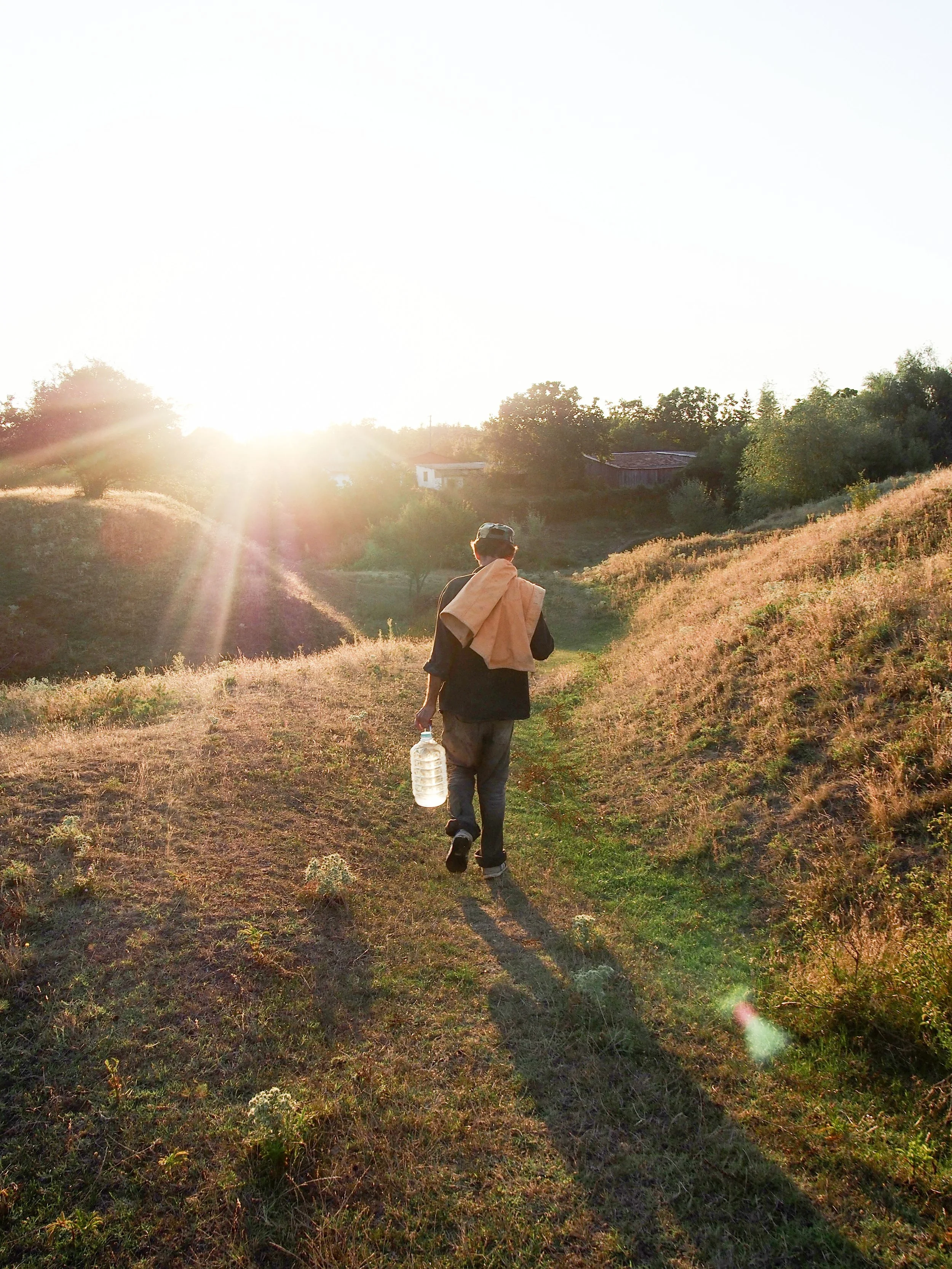
Măderat, Romania
The everyday village scene often features members of the older generation seated quietly outside their traditional homes, typically on a small wooden bench or porch facing the street. The atmosphere is one of peaceful, agricultural life, where chickens and sometimes other small livestock wander freely in the yard and along the roadside verge, scratching at the dry dirt. As neighbors, returning farmers, or simply passersby walk past, the scene is punctuated by brief, genuine moments of connection—quick stops for a short conversation, a friendly wave, and the customary Romanian greeting, often a simple "Bună ziua" (Good day), reinforcing the tight-knit, communal fabric of this viticultural village. This traditional rhythm coexists with a new economic reality: much of the younger generation often leaves the village to seek work in other European Union countries, thus abandoning inherited homes as the village's traditional life struggles against demographic decline.
No results match your search. Try removing a few filters.